
It’s “Flip-time,” NoBo PCT thru-hikers! 🥾
From the on-trail, on-snow photos I’ve seen by Melissa Glass, the NorCal snowpack is quite nice and supportive for snow-hiking right now. (See my comments on her pictures).
Not only are the slopes less steep and precarious than in the Sierra, the snow has consolidated and solidified such that I don’t see any postholing going on. This is great news and will probably hold true, as it did for me, for going through Oregon in June and July and Washington in August. 🌞
The Sierra is about to enter its “Thaw” period at PCT trail elevation, meaning the snow will be transforming from frozen and airy, inside (conducive to serious postholing when soft), to wet and soupy throughout with little, if any, re-freezing to happen at night. When this mess starts heating up and thawing out, the local creeks will rise in depth and speed and become highly dangerous for fording. 🌥️
This area should be avoided during this up-coming period of time, unless one reasonably believes they can ascend high enough on each creek encountered to find safe passage across.
I am specifically speaking to all creeks where, at trail elevation, there are miles of snow-filled drainage upstream melting and filling that creek to where it’s a raging torrent downstream, where the trail crosses it. The little and short creeks don’t typically acquire enough melt-inspired run-off to swell significantly to threaten a safe ford.
NorCal, and all elevations below 10,000-feet thus far this spring, have been thawing out for weeks already, so much consolidation has happened. The huge snow-fields of the vast Sierra, in contrast, will be just snow-patches to the north, as attested by the photos.
If I were not savvy with general mountaineering on steep snow, I’d seriously consider bailing out of the Sierra at Mammoth and heading up to the lower elevation forests of NorCal. Yes, you will have snow for most of your summer through Oregon and Washington, but it won’t be steep and you’ll have learned the art of moving over it safely. Return to the Sierra after M78!
Sierra Thaw safety note:
NoBo PCT thrus – You Do Not Have to Cross a Creek Where the Summer Trail does!
Look at your map and see if the trail re-crosses the creek, again, higher up, before you risk your life making a “first-cross.” Case in point is the South Fork of the Kings River between Pinchot and Mather Passes – You Do Not Have to Ford this raging torrent!
To get across all other nasty, whitewater fords, explore upsteam for safe routes across, first on dry surfaces, like logs and rock-hops, then via immersion in flat meadows.
If you are not comfortable with this strategy, bail even earlier at Kearsarge Pass and come back, later.
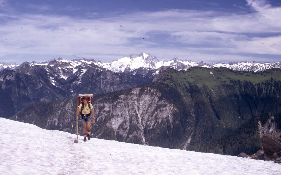
[photo: Fire Creek Pass on the flank of Glacier Peak around the end of August, 1974. “See, Mom…no postholing!”]