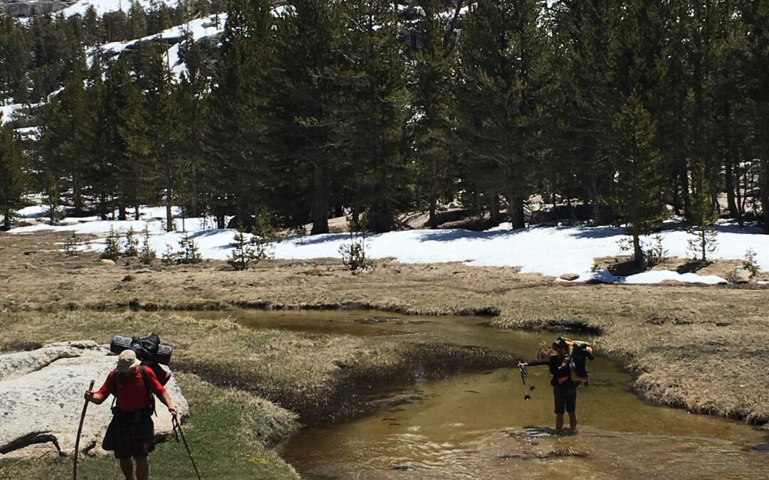
A small, 2023 creek-crossing Primer for thaw-fed Sierra creeks:
I have added a new subset term to my quantitative references to the Sierra snowpack. There have been “drought,” “normal,” and “heavy” winters, but I must add, now, the term, “Huge,” for obvious reasons!
So, after the “huge” winter of 2023 and, if you’re on-trail during the Sierra Thaw, which should be EPIC (June, July, August and, maybe, into September this summer!), I’m tempted to say that all of the creeks will have the potential to be dangerous crossings.
Quick, Creek-crossing Primer:
- You do not have to cross the creek where the summer trail does (search upstream for a safer spot to dry-cross, first, then acquiesce to a wet-cross),
- Avoid crossings, if you can (check your map to see if you really have to. Does the trail re-cross the creek upstream?),
- If you can’t, search up and down the creek at least a mile in each direction for a dry crossing (rock-hop, log crawl, bush-leaps, or simple jumps).
- The safest place to make a wet crossing is in a flat meadow for the following reasons
- The water depth is lower because the span is wider (less “push” on the body and safer for those with short legs),
- The rate of flow is slower because the grade is flatter (less “push” on the body),
- Due to decreased flow rates, their deeper channels are often less deep,
- The creek bed is smoother and kinder on your feet and route-finding due to less erosion from steep, fast currents,
- The water is clear making for easy route-finding because there are no big boulders on the bottom throwing the water in the air and turning it white (you can see where to put your feet),
- It is usually easier to get into and out of creeks in meadows,
- There is usually an open, grassy spot on the other side in which to dry out in the sun (hopefully),
- There is a lower likelihood of dangerous “strainers” residing in the current downstream under which you might get pinned and drown, should you fall, and
- You can cross pretty much any way you like, single, paired, grouped, “trained,” or utilizing any other technique you’ve heard of.
So, if you don’t find a dry way across a nasty creek, look on your topo map for a meadow nearby!

