
2023 JMT thru-hikers:
Those NoBo PCT thru-hikers with the savvy and skills to continue on north and through the Sierra, past Kearsarge and Bishop Passes, have seen and experienced the incredible beauty of the Range of Light under a blanket of snow, all while the snowpack remained unseasonably cold, due to cloud cover and off-shore storm systems throwing cool, arctic air onto the Range.
These early and determined thrus have had both the mental acuity/reasoning and physical experience to know what to do when environmental challenges of rain and warmth met them head-on in the form of softening snow bridges and rising creek/rivers.
These qualities kept them safe in a pretty austere setting where any kind of trouble often leads to evacuation.
However, the Sierra Thaw is coming to 11,000-feet and the snow bridges, there, will thin, soften, and collapse very soon. With this, the creeks will “open” up, rise, and transform into the torrents hikers rightfully fear. If such is the case when any of you arrive at the summer crossing of a creek, remember:
1. You do not have to cross any creek where the summer trail does in order to not become lost! If you are able to find a dry log crossing or a wet meadow one upstream, once you get to the other side, dry off, and warm up, remember that all you have to do is follow the creek downstream to intersect with the trail.
2. It may be that you don’t have to cross it at all! Before crossing, always consult with your topo map to make sure that you actually have to cross it. Often times in the Sierra, the summer trail will re-cross the creek higher upstream, thus, there’s no need to ford at a dangerous site when it can be avoided by going cross-country along the creek to re-connect with the trail higher up. The perfect example of this is the crossing of the South Fork of the Kings River between Pinchot and Mather Passes.
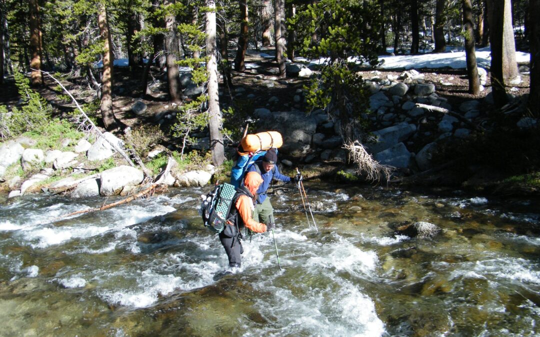
3. If you and your group decide that you have to cross a swollen stream, first, S.T.O.P. (Stop, Think, Observe, and Plan). Drop your packs and evaluate the creek’s forces and hazards while comparing them to the strengths of each member of your group. Ask yourself, “Does this site offer too much risk to the slightest and weakest member?”
If so, grab some water and food and go exploring for a safer, dry crossing across a log or rock-hop or a viable wet ford in a meadow where the creek will be,
– wider,
– slower,
– shallower,
– flatter,
– smoother-bottomed, and
– hopefully have a safe run-out downstream!
But, first, just “stop the train” and consider your options!
Thru-hiking the JMT this year is going to be challenging, as there may be more snow to negotiate, more water on the trail to walk through, and more nasty, dangerous creeks to try and cross (or not). If these risks are not in your skillset, choose another lower and dryer trail to hike. Know your abilities and the risks out there. Go prepared for what you might find.
The Mountains are calling and you can go. Choose those that offer conditions that every member of your party is prepared for. After all, there are beautiful mountains everywhere!
[This post has created a huge interest in Sierra Creek-crossing techniques for the expected, huge, Thaw-induced run-off expected for the summer of 2023. There’s lots more great info on the subject in the comments, below, all of which will be incorporated into a larger publication as soon as I can write it!]